LOW-GRADIENT RIVER FLOODPLAINS WORLDWIDE · NATURE
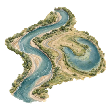
Oxbow lake cutoff study
What it means: Modern editorial interpretation: A contemporary image of a new route coexisting with a trace of an earlier path.
When a river takes a shorter channel across a meander neck, the former bend can become a separate oxbow lake. This generic plan-view study distinguishes the active river from the detached water body.
A river finds a shorter channel while an old bend remains beside it. The motif offers an editorial language for redirection that does not erase what came before.
Often chosen for: Care, gratitude & remembrance
Respectful use: Do not frame real flood impacts or displacement as automatically positive; no land-use or flood-safety advice. No real location, precise map, current flood condition or flood-safety interpretation is identified. Personal change or release readings should not romanticize flooding or displacement. This is an original generated decorative study, not exact specimen, map, route or technical documentation. Blue and gold are editorial colors. Any personal reflection is contemporary interpretation; only explicitly bounded cultural context is documented. No blanket commercial or manufacturing clearance is claimed.
Sources: [1] eros.usgs.gov